Find 2 Surveyors You Can Count On in Vancouver, BC

Browse services and customer feedback for 2 surveying firms serving Vancouver, BC. Check business profiles, see which companies handle your type of boundary, topographic or construction survey and contact suitable surveyors for more details and quotes.

Not rated yet
Photosat Information
33 Years
Not rated yet
Photosat Information provides high-precision geospatial data solutions using satellite imagery for mining, energy, and infrastructure projects worldwide. Our core offerings include elevation surveys, alteration mapping, and data insights derived from proprietary processing systems. With operations since 1993, we deliver engineering-grade accuracy without requiring ground access through advanced remote sensing technology.
Elevation Surveys Alteration Mapping Data Insights
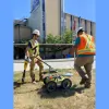
Geoscan Subsurface Surveys Canada specializes in subsurface utility engineering, ground-penetrating radar, and surveying services. We provide precise geophysical data to support infrastructure, environmental, and archaeological projects. Our client-focused approach combines advanced technology with certified expertise to ensure safety and project success.
Ground Penetrating Radar Utility Locating GIS Utility Mapping
Burnaby (10.4 km) North Vancouver (7.2 km) West Vancouver (8.5 km) Surrey (20.7 km)